Planning questions examined through regional and national lenses
Engaging in stakeholder dialogue is a key part of maritime spatial planning process. Governance of marine and coastal areas is dispersed across different levels of administration and, in order to manage the big picture, it is vital to consider both local and national actors. Strengthening interaction has been at the heart of the Baltic Sea2Land project, which has been implementing the Finnish Coastal Strategy for the last couple of years.

The pilots focused on planning questions relevant for regions.
The Finnish maritime spatial planning coordination group has been working on multi-level governance in Baltic Sea2Land project (2023-2025) by bringing together national and regional actors to discuss current maritime spatial planning issues through pilot projects. As part of the work, information exchange and discussion has also been promoted both horizontally and vertically between organisations, research, public authorities and industry representatives.
During 2024, four pilots were conducted on topical planning issues, three at regional and one at national level. The pilots were carried out with coastal regional councils in Kymenlaakso, the Saaristomeri catchment area and the northern planning area, which includes the northern Bothnian Sea, the Quark and the Bothnian Sea. In addition to developing stakeholder interaction, the pilots were motivated by the need to implement the updated coastal strategy and to contribute to better consideration of land-sea interaction in maritime spatial planning.
Using pilots to address coastal planning issues
All three regional pilots tackled different planning challenges. The pilot in the Archipelago Sea gathered information from stakeholders to examine the potential water impacts of renewable energy projects in the catchment area, the pilot in Kymenlaakso assessed stakeholders’ understanding of the need for blue-green connection marking, and the pilot in the Northern Planning Area assessed how maritime spatial planning could better take into account migratory fish, especially when coordinating offshore wind. The national pilot built on the results of the pilot in Kymenlaakso and looked at how to incorporate the blue green network designation more widely into maritime spatial planning.
Consideration of migratory fish in the Gulf of Bothnia
The Northern pilot brought together stakeholders in Kemi in October 2024 to discuss Finland’s Maritime Spatial Plan 2030 and the migratory fish issue. A representative from the Swedish maritime spatial planning was also invited, as both offshore wind developments in the Gulf of Bothnia and the Torneo River marking the border between Finland and Sweden, require a joint review. International cooperation in marine areas will become increasingly crucial in the future, for example in terms of managing the cumulative effects of different activities.
”We got many good ideas for development, for example in relation to the designation of important links for migratory fish in the plan. Cooperation with Sweden plays a major role also in this theme,” says Roosa Mikkola, Project Planner for Baltic Sea2Land.
This workshop was preceded by workshops held in Vaasa, Oulu and Tornio during autumn 2023, where planners, fisheries experts and offshore wind industry representatives jointly identified coordination challenges and solutions.
Blue-green network reflections in Kymenlaakso
A pilot on the southern coast in Kymenlaakso focused on the blue-green network and its development. Two workshops were organised during the pilot, the first of which examined the need for blue-green connection marking in the Kymenlaakso regional plan together with stakeholders. In the second workshop, landscape architecture students were brought in to work on and develop visions for the problem areas identified in the previous workshop together with stakeholders. You can read more about the work done with the students here.
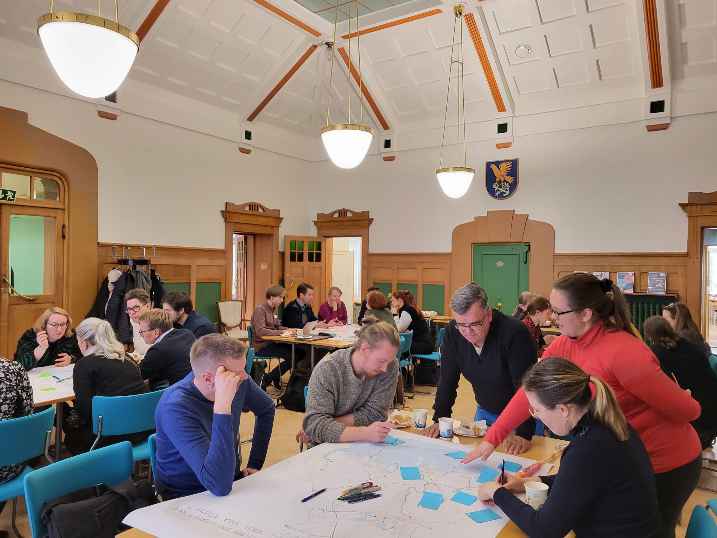
Workshopping in Kymenlaakso with blue-green connection markings.
”The pilot project in Kymenlaakso showed that although land-use planners can interpret the blue-green corridor marking, better communication to other stakeholders is needed,” says Mikkola. ”At present, the meaning of the map marking and the overall picture is not communicated to stakeholders in the desired way,” she continues.
The review initiated in the Kymenlaakso pilot was extended to the national level, as the need for clearer indication of the totality of nature values, connections and structures has been identified in the second round of maritime spatial planning. This work will be further developed as the MSP revision continues.
Water impacts of renewable energy production in the Archipelago Sea catchment area
The third regional pilot in the Baltic Sea2Land project focused on the hydrological impacts of renewable energy production in the catchment area of the Archipelago Sea. The region faces a challenge with eutrophication, which is why it was considered important to raise the issue. The pilot identified and gathered existing knowledge on the water impacts of the rapidly expanding industrial-scale solar energy production. Results of the workshop between public authorities, regional planners, water protection experts and municipalities highlighted the need for multi-stakeholder involvement in the assessment of the cumulative water impacts of projects. Locating power plants on the most suitable land, such as already developed areas, will reduce water pollution.
”The workshops we organised in the different pilots were an excellent example of how valuable understanding can be created by gathering together. With coastal zone management fragmented at different levels, dialogue allows for more effective planning solutions,” says Mikkola, summing up the work done in the different regions.
Participation and dialogue will continue through 2025
Overall, the pilot projects have strengthened maritime spatial planning by increasing stakeholder participation, refining decision-making processes and promoting environmental integration in coastal and marine areas. The insights gained from the workshops will be taken into account in the ongoing revision of the MSP.
Spring 2025 will be a busy time for maritime spatial planning stakeholder work – in March, 10 industry meetings will be held as part of the Marine Vision phase of the second planning cycle. Industry will be met in the spring for national-level discussions, followed by more detailed regional-level reviews in the three planning areas.
The theme of multi-level governance has been taken up in Finnish maritime spatial planning with the support of the Baltic Sea2Land project (2023-2025). The aim is to strengthen cross-sectoral planning by involving stakeholders at national, regional and local level.
The project will create a new Navigator planning platform to support spatial planning. Navigator provided valuable support for the planning issues during the pilots. Navigator’s MLG tool helped to identify key sectors and stakeholders, ensuring broad and participatory involvement. It also provided a framework for analysing internal working methods and documents, clarifying stakeholder linkages and refining workshop methods to ensure that insights effectively informed decision-making.
Read more about the Baltic Sea2Land project here.