Maritime spatial planning process 2017–2021
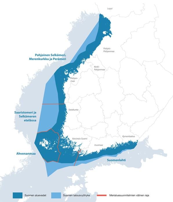
Finland’s eight coastal regions will develop three maritime spatial plans by the end of March 2021. The Åland Islands will compile its own plan.
The maritime spatial plans will be prepared in cooperation with stakeholders. It is possible to participate in planning in accordance with the interaction plan. You can register with the maritime spatial planning cooperation network here (in Finnish).
Maritime spatial planning promotes sustainable development and growth for different marine uses, the sustainable use of natural resources, and the achievement of the good status of the marine environment.
Maritime spatial planning involves coordinating the needs of different maritime users and industries. Planning will focus particularly on the following sectors: energy, maritime transport, fisheries and aquaculture, tourism, recreational use, and conservation, protection and improvement of the environment and nature. Other themes, such as cultural heritage, mining industry, blue biotechnology, and maritime industry will be addressed. There will also be an emphasis on national security needs, the characteristics of the marine areas, and land-sea interactions.
Maritime spatial planning cooperation is guided by a coordination group that includes representatives of the 8 coastal regional councils and the Ministry of the Environment. The Regional Council of Southwest Finland has a coordination responsibility.
Maritime spatial planning is regulated in the Land Use and Building Act (in Finnish).