The Navigator tool launched at the 5th Baltic MSP Forum
The 5th Baltic Sea MSP Forum brought together experts in maritime spatial planning in the Baltic Sea region in Riga on November 11-12, 2025. The forum is held every few years, and this time it also served as the final conference of the Interreg Baltic Sea2Land project. In addition to discussing the final outcome of the project, the Navigator tool, the participants discussed many current topics, ranging from overall security to cross-border consideration of marine nature.
The 5th Baltic Sea Maritime Spatial Planning Forum in November featured wide-ranging discussions on current cross-border planning challenges. These topics included the impacts of climate change on the marine environment and coastal and archipelago communities, the consideration of ecosystem services in planning, and security issues. Despite the variety of topics discussed, one thing was clear: we need cooperation. Knowledge exchange between countries and joint guidelines, policies, and operating models must be developed. At the event, existing good cooperation platforms were acknowledged, emphasizing the importance of their continuity. Joint projects such as Interreg Baltic Sea2Land (2023–2025) also serve as important channels for building connections.
The final product of the Baltic Sea2Land project, the Navigator tool, was officially launched in Riga. The tool was tested in several pilots carried out during the project. The tool provides support for, among other things, structuring stakeholder work and taking into account the multi-level governance structure as part of spatial planning processes. The sessions of the final seminar largely reflected the planning questions addressed in regional and national pilots in different partner countries.
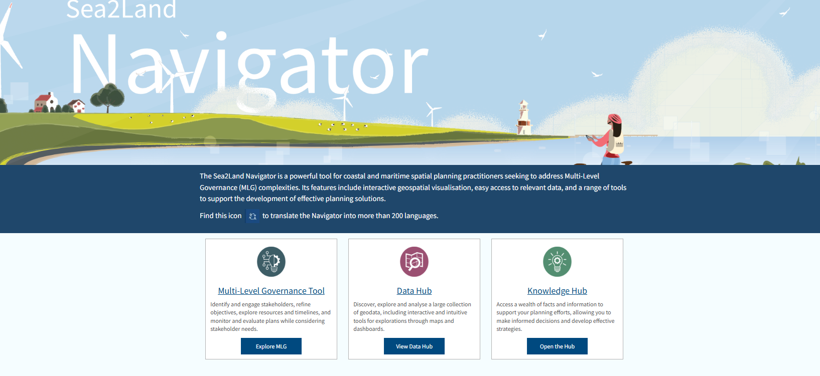
Screenshot of the front page of the publicly available digital tool. Click on the image to explore Navigator.
Blue-green connections are an important part of considering marine nature
In Finland, the blue-green infrastructure theme has been addressed in two pilots, one regionally in Kymenlaakso and one nationally within the Maritime Spatial Planning Coordination Group. Discussions continued at the Riga forum, broadening the scope to include steps taken more broadly in the Baltic Sea region. Experiences were also heard from our neighboring country Sweden, where cooperation between the selection process for marine protected areas and maritime spatial planning has been intensified. At the heart of the Blue-Green Infrastructure is connectivity and the preservation of natural values also outside protected areas. In many issues related to marine nature and connectivity, the focus should be on the Baltic Sea as a whole, but in practice this is still challenging to achieve. Discussions on this theme will continue in Finland as part of the maritime spatial planning process. The pilots carried out within the framework of the project provided a valuable basis for further considerations.

The blue-green infrastructure pilots implemented in the Baltic Sea2Land project were discussed in Riga. Pictured is Frank Hering, chair of the Maritime Spatial Planning Coordination Group, from the Regional Council of Kymenlaakso.
A shared security vision for the Baltic Sea
The variety of security issues, uncertainties related to Russia’s actions, and increasingly limited opportunities for open information sharing pose challenges for the maritime operating environment. As a topical issue, one of the sessions focused on the associated challenges. In Riga, it was noted that in the current circumstances, a cross-cutting approach to security is also necessary in maritime spatial planning, as maritime transport, energy production and transmission, fisheries, and coastal communities all play an important role in maintaining the essential functions of our society. However, it should be noted that the scale of the analysis varies from sector to sector – maritime transport is a global activity and challenges such as tackling shadow fleets require cooperation at the global level. On the other hand, underwater infrastructure and its security is an issue between the Baltic Sea countries.
The role of maritime spatial planning in responding to security threats was seen primarily as maintaining inter-sectoral dialogue and predicting changes in the operating environment. Thinking ahead, the possibility of joint security scenario work across the entire Baltic Sea region was considered. Such an exercise could lead to a unified view on preparedness measures in crisis situations.
The Baltic Sea2Land project is coming to an end
You can learn more about the Interreg Baltic Sea2Land project, due to end in December 2025, on our website here and on the project’s homepage on the Interreg platform.
Four pilot projects were carried out in Finland as part of the project:
- Timeliness of the Kymenlaakso regional plan 2040 – promoting blue-green connections from the perspective of stakeholders (2023–2024)
- Promoting migratory fish by means of maritime spatial planning in the northern planning area (2023–2024)
- The impact of renewable energy on water bodies in the catchment area – focus on the Archipelago Sea (2024)
- National pilot project on the integration of blue-green infrastructure into the maritime spatial plan based on the lessons learned from the Kymenlaakso Regional Council’s regional pilot project (2024)
Navigator: Baltic Sea2Land Navigator
Massive Open Online Course (MOOC): Baltic Sea2Land Navigator Course